File: Europe20000ya.png

Size of this preview: 800 × 532 pixels. Other resolutions: 320 × 213 pixels | 640 × 426 pixels | 1,024 × 681 pixels | 1,280 × 852 pixels | 1,900 × 1,264 pixels.
Original file (1,900 × 1,264 pixels, file size: 107 KB, MIME type: image/png)

 Any autoconfirmed user can overwrite this file from the same source. Please ensure that overwrites comply with the guideline.
Summary
| Description |
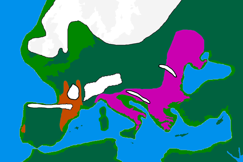
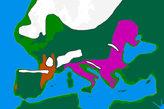
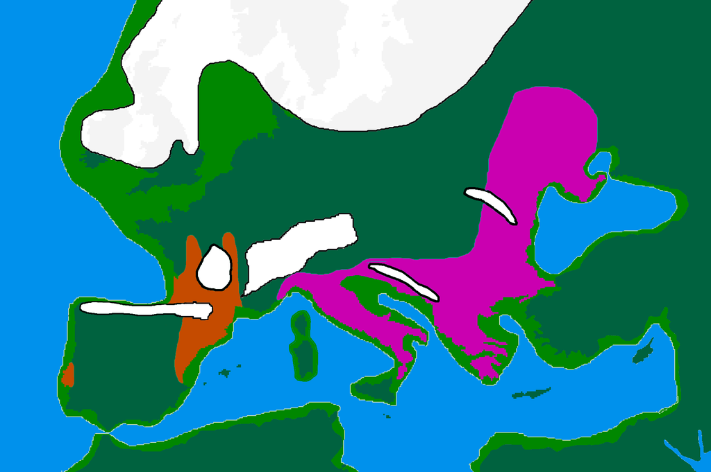
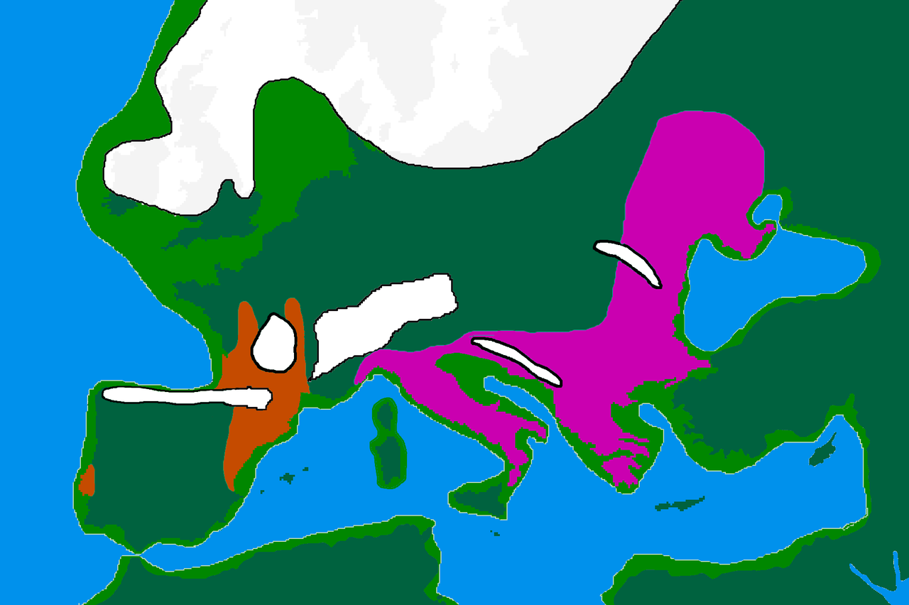
English: map of Europe 20,000 years ago
Solutrean and Proto Solutrean Cultures; Franco-Cantabrian region
Epi Gravettian Culture
Coloured areas are the furthest extent of the cultures between 15 kya and 20 kya. glaciers covering today's landmass
glaciers over present-day sea
non-glaciated landmass at that time, today's sea
other non-glaciated landmass Deutsch: Karte von Europa vor 20.000 Jahren
and Proto-Solutrean-Kulturen;
Epi--Kultur
Die farbigen Bereiche zeigen die größte Ausdehnung der Kulturen zwischen 15.000 und 20.000 Jahren vor heute. Gletscher über heutiger Landmasse
Gletscher über heutigem Meer
damalige nicht vergletscherte Landmasse, heutiges Meer
sonstige nicht vergletscherte Landmasse |
| Date | |
| Source |
English: made by me from Image:BlankMap-Europe-v3.png, which is GFDL v1.2, outline of ancient coast and extent of ice added by me from information from "After the Ice: A Global History" by Steve Mithen. Information about human refugia from "Origins of the British" by Stephen Oppenheimer and "Out of Eden by Stephen Oppenheimer. These were sketched in by me from information supplied by these books.
Deutsch: Von mir erstellt auf der Grundlage von Image:BlankMap-Europe-v3.png, das unter GFDL v1.2 steht; die Umrisse der antiken Küstenlinie und die Ausdehnung der Eisflächen wurden von mir anhand von Informationen aus After the Ice: A Global History von Steve Mithen hinzugefügt. Informationen zu menschlichen Refugien stammen aus Origins of the British von Stephen Oppenheimer und Out of Eden von Stephen Oppenheimer. Diese wurden von mir anhand der in diesen Büchern enthaltenen Informationen eingezeichnet. |
| Author | User:Wobble |
| Permission (Reusing this file) |
GFDL |

Licensing

|
Permission is granted to copy, distribute and/or modify this document under the terms of the GNU Free Documentation License, Version 1.2 or any later version published by the Free Software Foundation; with no Invariant Sections, no Front-Cover Texts, and no Back-Cover Texts. A copy of the license is included in the section entitled GNU Free Documentation License. |
  
|
This file is licensed under the Creative Commons Attribution-Share Alike 3.0 Unported license. | |
| ||
| This licensing tag was added to this file as part of the GFDL licensing update. |
File history
Click on a date/time to view the file as it appeared at that time.
| Date/Time | Thumbnail | Dimensions | User | Comment | |
|---|---|---|---|---|---|
| current | 17:35, 1 November 2026 | | 1,900 × 1,264 (107 KB) | wikimediacommons>Derkoenig | adjust the exact shade of white for the southern glacier areas to match the Scandinavian glaciers |
File usage
The following page uses this file:
